
WY Map - Wyoming Maps
State Maps > WY Map
Basic State Maps | |||||||||
|---|---|---|---|---|---|---|---|---|---|
| AK | CO | HI | KS | ME | MT | NJ | OK | SD | VT |
| AL | CT | IA | KY | MI | NC | NM | OR | TN | WA |
| AR | DE | ID | LA | MN | ND | NV | PA | TX | WI |
| AZ | FL | IL | MA | MO | NE | NY | RI | UT | WV |
| CA | GA | IN | MD | MS | NH | OH | SC | VA | WY |
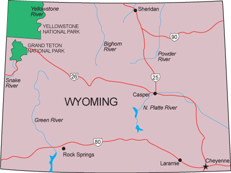
More detailed WY maps, both online and printed, are available at the Wyoming Department of Transportation and the Wyoming Game and Fish Department. Visit the Wyoming Geospatial Hub website for geographic information about the State of Wyoming.
Click any of these state map links to view simple state maps and find state geographic info.
Copyright © 2007-2026 State-Maps.org. All rights reserved.
Wyoming map copyright © Bruce Jones Design Inc.
Wyoming map copyright © Bruce Jones Design Inc.