
MD Map - Maryland Maps
State Maps > MD Map
Basic State Maps | |||||||||
|---|---|---|---|---|---|---|---|---|---|
| AK | CO | HI | KS | ME | MT | NJ | OK | SD | VT |
| AL | CT | IA | KY | MI | NC | NM | OR | TN | WA |
| AR | DE | ID | LA | MN | ND | NV | PA | TX | WI |
| AZ | FL | IL | MA | MO | NE | NY | RI | UT | WV |
| CA | GA | IN | MD | MS | NH | OH | SC | VA | WY |
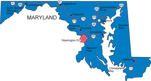
More detailed MD maps, both online and printed, are available at the Maryland Department of Transportation and the Maryland Department of Natural Resources. Visit the Maryland Mapping Resource Guide for geographic information about the State of Maryland.
Click any of the state map links on this page to view simple state maps and find state geographic info.
Copyright © 2007-2024 State-Maps.org. All rights reserved.
Maryland map copyright © Bruce Jones Design Inc.
Maryland map copyright © Bruce Jones Design Inc.