
Nevada Map
 |
 |
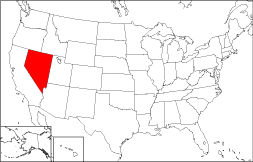
Where Is Nevada?
The State of Nevada, displayed in red on the map to the right, is bounded by Utah on the east and by California on the west. It is bordered by Idaho to the northeast, by Arizona to the southeast, and by Oregon to the northwest.
Nevada Maps
Nevada is the 7th largest state in the United States, and its land area is 109,826 square miles (284,449 square kilometers). The state's administrative divisions consist of sixteen counties and the independent capital city. This Nevada map site features road maps, topographical maps, and relief maps of Nevada. The detailed, scrollable road map displays Nevada counties, cities, and towns as well as Interstate, U.S., and Nevada state highways. The pannable, scalable Nevada street map can be zoomed in to show local streets and detailed imagery.
Nevada Highway Map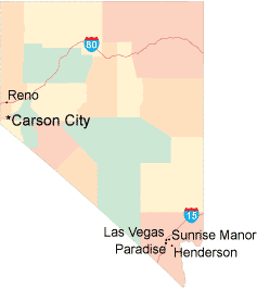 Click on the highway map thumbnail
to view a scalable Nevada road map. |
NV Topo Map Click map to enlarge.
|
NV Relief Map Click map to enlarge.
|
The detailed Nevada map and the regional Nevada map display cities, roads, rivers, and lakes as well as terrain features. The detailed map shows only the State of Nevada, while the regional map shows Nevada and the surrounding region.
Nevada Infrastructure > Nevada Airports
In 2005, the population of Nevada was estimated at 2,412,301, which is about 22.0 people per square mile. In 2010, Nevada's population rose to 2,700,551 people. More recently, in the 2020 census, the Nevada population was 3,104,614. Nevada's Interstate Highways include I-15 and I-80.
Nevada Topography
Nevada is derived from the Spanish word "nevada", meaning "snow clad", a reference to the high Sierra mountains in the western part of the state. Much of Nevada lies in the Great Basin, but the Sierra Nevada range rises steeply toward the west. Visitors are drawn to Lake Tahoe and to Lake Mead, which forms an oasis behind Hoover Dam in the southeast. In Las Vegas and Reno, gamblers are drawn to the glittering casinos, which are a major revenue source for the state. For additional Nevada travel and tourism information, visit the official Nevada tourism site and Nevada Atlas.
Other Maps of Nevada
This Nevada reference map shows major cities, roads, railroads, and physical features in Nevada.Several map publishing companies offer printed maps of Nevada. For example, Omni Resources offers several maps of Nevada that feature points of interest, airports, and parks, as well as selected local attractions and insets of major Nevada cities.
All rights reserved.
Certain maps hereon are © Map Resources or Digital Wisdom.
To facilitate browsing, certain external links will open in new windows.
Nevada-Map.org Editor, State Maps, PO Box 828, Barnegat, NJ 08005.