Florida Airports
|
North Florida Airport Map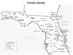 |
South Florida Airport Map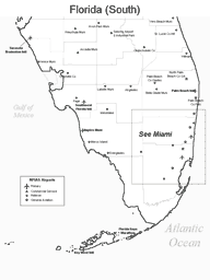 |
Tampa Area Airport Map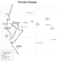 |
Miami Area Airport Map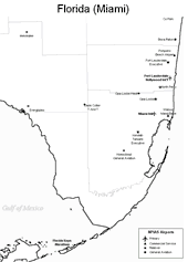 |
 Leading international airports in Florida include
the Fort Lauderdale Hollywood International Airport,
the Miami International Airport,
the Orlando International Airport, and
the Tampa International Airport.
Leading international airports in Florida include
the Fort Lauderdale Hollywood International Airport,
the Miami International Airport,
the Orlando International Airport, and
the Tampa International Airport.
Medium hub airports in Florida include the Jacksonville International Airport, the Palm Beach International Airport in West Palm Beach, and the Southwest Florida International Airport in Fort Myers.
The photo at right is an aerial view of Miami International Airport.
Interactive Florida Airports Map
This section features an airport locator map that can be zoomed and panned to show the state of Florida and its neighbors or a small region of the state. Use the plus (+) and minus (-) buttons to zoom the map in and out, respectively. Simply swipe or drag the map to pan it in any direction. The airport markers on this Florida map can help travelers find IATA-designated airports in the state and plan their air travel arrangements more efficiently.
Copyright © 2007-2026 State-Maps.org. All rights reserved.
Florida airport map source: FAA 2001-2005 NPIAS.
Florida airport map source: FAA 2001-2005 NPIAS.