
Arizona Airports
|
 Leading airports in Arizona include
the Phoenix Sky Harbor International Airport and
the Tucson International Airport.
More than 20 domestic and international airlines operate at Sky Harbor
Airport. Tucson's airport features more than 80 daily nonstop
departures to 24 destinations.
Leading airports in Arizona include
the Phoenix Sky Harbor International Airport and
the Tucson International Airport.
More than 20 domestic and international airlines operate at Sky Harbor
Airport. Tucson's airport features more than 80 daily nonstop
departures to 24 destinations.
Other major Arizona airports include the Flagstaff Pulliam Airport, the Grand Canyon National Park Airport, the Laughlin/Bullhead International Airport in Bullhead City, the Page Municipal Airport, and the Yuma International Airport.
The photo at right is an aerial view of Phoenix Sky Harbor Airport.
Interactive Arizona Airports Map
This section features an airport locator map that can be zoomed and panned to show the state of Arizona and its neighbors or a small region of the state. Use the plus (+) and minus (-) buttons to zoom the map in and out, respectively. Simply swipe or drag the map to pan it in any direction. The airport markers on this Arizona map can help travelers find IATA-designated airports in the state and plan their air travel arrangements more efficiently.
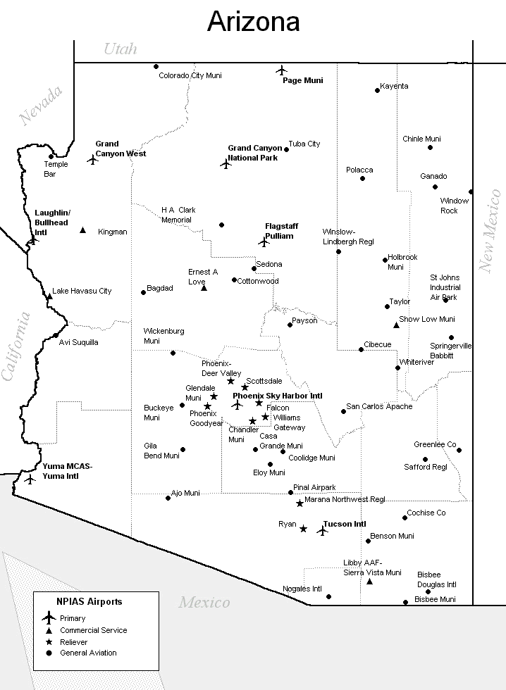
FAA Arizona Airport Locator Map
This Arizona airport map shows FAA-designated commercial service airports, reliever airports, and general aviation airports in the State of Arizona. Primary airports are designated with an airplane symbol.
Copyright © 2007-2026 State-Maps.org. All rights reserved.
Arizona airport map source: FAA 2001-2005 NPIAS.
Arizona airport map source: FAA 2001-2005 NPIAS.