
Alabama Airports
|
 The two international airports in Alabama are
the Birmingham-Shuttlesworth International Airport and
the Huntsville International Airport.
Birmingham's airport serves the Greater Birmingham area and surrounding
cities with more than 160 daily arrivals and departures to major cities
throughout the USA.
The two international airports in Alabama are
the Birmingham-Shuttlesworth International Airport and
the Huntsville International Airport.
Birmingham's airport serves the Greater Birmingham area and surrounding
cities with more than 160 daily arrivals and departures to major cities
throughout the USA.
Other major Alabama airports include the Dothan Regional Airport, the Mobile Regional Airport, and the Montgomery Regional Airport.
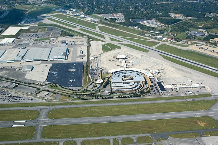
The photo at right is an aerial view of Birmingham International Airport.
Interactive Alabama Airports Map
This section features an airport locator map that can be zoomed and panned to show the state of Alabama and its neighbors or a small region of the state. Use the plus (+) and minus (-) buttons to zoom the map in and out, respectively. Simply swipe or drag the map to pan it in any direction. The airport markers on this Alabama map can help travelers find IATA-designated airports in the state and plan their air travel arrangements more efficiently.
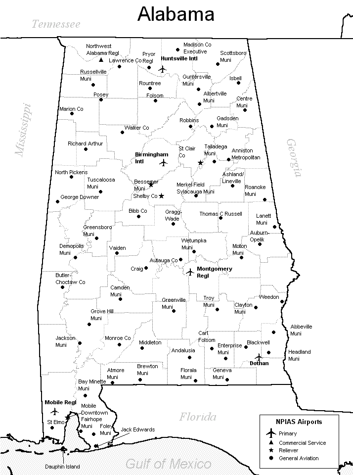
FAA Alabama Airport Locator Map
This Alabama airport map shows FAA-designated commercial service airports, reliever airports, and general aviation airports in the State of Alabama. Primary airports are designated with an airplane symbol.
Copyright © 2007-2026 State-Maps.org. All rights reserved.
Alabama airport map source: FAA 2001-2005 NPIAS.
Alabama airport map source: FAA 2001-2005 NPIAS.